More than 95 percent of all cell phone towers on Puerto Rico are out of service after Hurricane Maria impacted the island with category 4 winds on September 20, according to a report by the Federal Communications Commission.
Two 911 emergency service centers (PSAPs) in the U.S. Virgin Islands at St. Croix and St. Thomas are experiencing issues, unable to receive some caller location information.
Unfortunately, getting Puerto Rico’s communications networks up and running will be a challenging process, particularly given the power outages throughout the island. But the FCC stands ready to do whatever we can to help with this task. My thoughts and prayers are with the people of Puerto Rico.
Statement from FCC Chairman Pai
A number of counties on Puerto Rico are completely without cell service, and the majority of the rest only have a few towers still operational. Only 25 of 107 cell towers on the U.S. Virgin Islands are operational at this time.
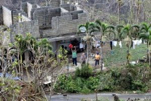
Puerto Rico’s entire power network was knocked offline due to the storm, and it may take ‘months’ to restore power to everyone, according to Governor Ricardo Rossello. In an interview with CNN, he said that damage reports were still being taken and that the ‘impact of the storm on the island territory won’t be realized until officials can do a flyover and see what remains.’
Rossello raised the death toll from the storm to 13 on Thursday. Another 15 were reported to have been killed on the island of Dominica, which saw the storm pass as a category 5 hurricane.
Satellite provides backup to ground-based radar
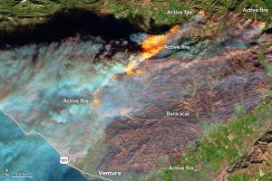
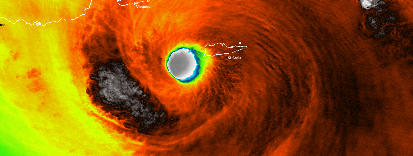
In addition to causing catastrophic damage to the island and the cell and power grids, Maria also took the ground-based radar in San Juan offline at around 5:50 a.m. EDT on September 20th, around two hours before landfall. Without radar, meteorologists are unable to “see” into the storm to detect where the highest winds are and where the most rain is falling.
Preliminary Major Hurricane Maria Estimated Rainfall across Puerto Rico & U.S. Virgin Islands. #prwx #usviwx pic.twitter.com/mcluYuSBcR
— NWS San Juan (@NWSSanJuan) September 21, 2017
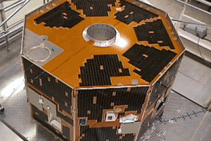
A new National Oceanic and Atmospheric Administration weather satellite launched late last year was able to fill the data gap and helped provide meteorologists with the critical data needed to be able to inform the public about the hurricane’s dangers. GOES-16, which is still in a checkout and testing phase, is more capable than the previous weather satellites launched by the U.S. Instead of only being able to take measurements and photos of the storm every five minutes like the previous satellites, GOES-16 is able to scan and do the same up to every 30 seconds with more granular detail.
In the absence of radar, GOES-16 data helped fill the void and allowed forecasters to keep an eye on Maria, which made landfall on September 20 near Yabucoa, Puerto Rico, around 6:15 a.m. EDT as a category 4 hurricane. Forecasters continue to use the new capabilities available from GOES-16 to track the storm.
NASA GOES-16 press release
NOAA satellites were instrumental in providing not only wind speed data of the storm, but showing forecasters where to expect rain and subsequent flooding.